Dartmoor
and by the
South Devon Coast Path
October 16th - 23rd, 1999
Launched October 24th, 1999
Ronald Langereis - 1999 - Amsterdam
Day Two - Sunday, October 17th
First hike on the moors - Ivybridge to Scorriton - 12.5 m
Emotional mileage: Beyond 20 m
| Pictures | Description | |
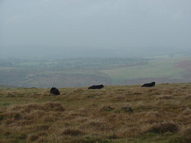 |
Imperturbable cows of the free roaming kind ruminating on top of the moor along the Two Moors Way | Our first walk happens to be the official first stage of the 'Two Moors Way'. For the greater part this 'way' is leading across so-called 'open access land', which means that one may roam here at will without any restriction to keep to a path. However, prudence prescribes to follow the track; the moors stretch out too far to take any risks. Outside the open access land we'll find at times a simple post inscribed with 'MW' over an arrow that indicates the right direction. On the moors proper no indications of any kind are to be found, but as far as orientation goes, for a considerable part of our walk the path is following the tracks of a dismantled tram-way. In former days this was used for the transportation of labour and materials to produce granite and tin and even porcelain clay. We'll set out from Ivybridge railway station and at first follow the footpath skirting the tracks, the railway defining the border of Dartmoor National Park. At a railway-bridge we'll join the Two Moors Way, that's coming up from the Ivybridge village-green below. Turning to the right, we'll find on the bridge the DNP logo, a frisky pony, heralding coming views of its living equals which we will encounter roaming on the moors. The grounds here are marshy, abounding with swamps and little ponds, even high up in the hills. The water absorbed by the shallow layers of peat and vegetation is prevented from seeping into deeper soil by the bedrock of impenetrable granite. Some of the ponds, however, are man-made. Passing Leftlake Mires the remnants can be seen of the winning of porcelain clay, which was abandoned in 1932, the lake overthere being the former clay-pit. A little further on, when the old tram-way branches off to the east (right), we're near the highest point of the route. On a clear day we'll be able to discern the naval base of Plymouth, lying behind us to the south-west. Here, following a wide bend to the right, we'll leave the tracks of the tram-way and join the Abbot's Way, once a short-cut between the abbeys of Tavistock and Buckland in the west and Buckfast in the east. After our lunch at the discarded tin-mine we took a different track by mistake. It resembled a dry water-course, hollowed out into the peat, with up-going sides and a grassy bottom strewn with stones. After a while, having reached the end of a high plane, we realized we were heading in the wrong direction, going parallel to a brook down to our left we should've crossed way back before. Having taken our bearings, we waited for the second part of the group to come into sight and then set out on a new, northerly course, signalling the others to follow suit. After twenty minutes of stiff climbing on a slowly rising slope, we reached a top that overlooked the brook and undulating hills beyond it, without any trace of a path or a bridge. There was a steep descent to the brook over very rough terrain, overgrown with high grasses hiding treacherous water-holes. Down by the brook the going was even worse and there seemed to be no viable way to reach the opposite side. The ford that was indicated on the map proved out of existence. A minority started to engage the swamps by the brook, going westward to find a more distant bridge, while the others settled on the bank, as in the rear one of us had sprained her ankle and wouldn't move any further. After about an hour, just when the foremost of our party came into view on the opposite bank, a couple of hikers appeared from above. They put off their shoes and briskly forded the brook in front of our incredulous eyes. That resolved the situation. The next moment everyone was busy undoing his shoes and within ten minutes the whole party was over, wetting hardly their calves. Having rejoined with the ones who had made the detour to the bridge, we climbed the next slope, only to reach a barren and wind-swept plane. There we huddled together on a solitary stone, until Wim and Toon returned from a reconnaissance. They had found a track, which eventually brought us to Scorriton. |
 |
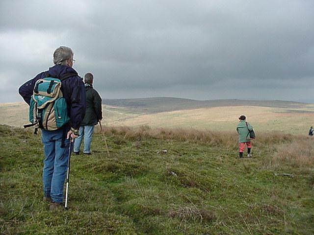
Enjoying the view (next picture), during a first coffee-break. Stones for seats are lavishly provided for by Nature herself | |
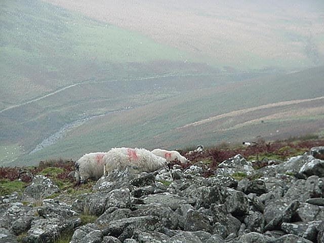 |
It's most probably a tributary of the Dart that is meandering here at the bottom of the slope, if not the Dart herself | |
 |
As the air was chilly and damp, we were glad to find a shelter for lunch. Seems to have been part of an old tin-mine | |
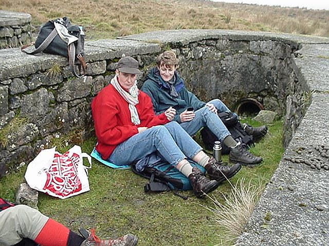 |
Zwanda and Minke having lunch in front of the drain-pipe by which the water was let out of the bassin | |
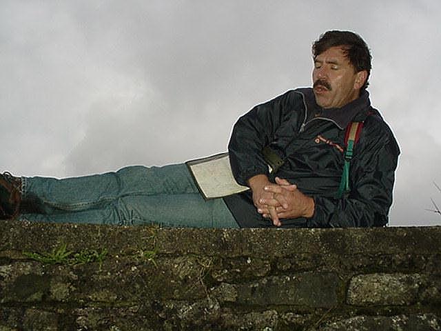 |
Lying loosely on top of the wall, Ruud appears to have fallen to chanting, but I swear he wasn't | |
 |
Half an hour before it had dawned on us we had lost our way. Elly almost looks forlorn in the rough vegetation without any sign of a path | |
 |
Our guides gone, looking for a bridge that wasn't there, the group is left to fend for itself. Mutinous feelings have to be handled before one is prepared to engage the steep and treacherous descent to the brook | |
 |
Having crossed the brook unshod, eventually, the rear is slowly scaling the pitiless slope back to the top of the still inhospitable moor | |
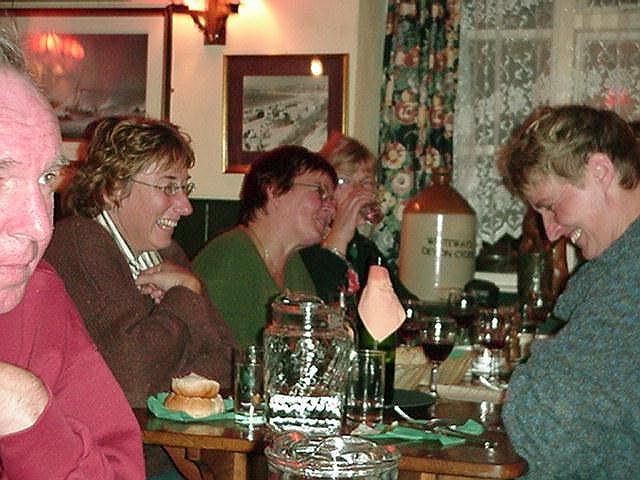 |
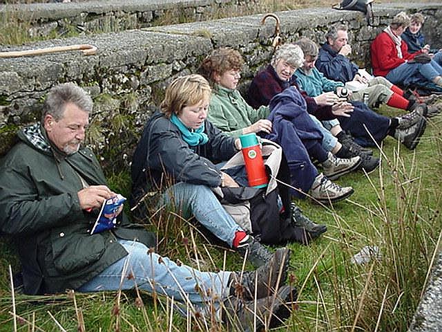
There was no home cooking this evening. In the pub the hardships of the first stage were quickly forgotten | |
 |
It was a cosy pub, the name of which I never noticed, as we were led there by hollow roads in utter darkness and once inside went straight for the grub | |
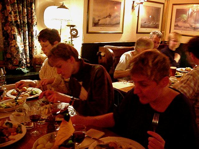 |
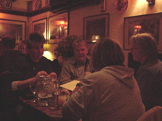
A brisk walk on the wind-swept moors asks for a hearty meal | |
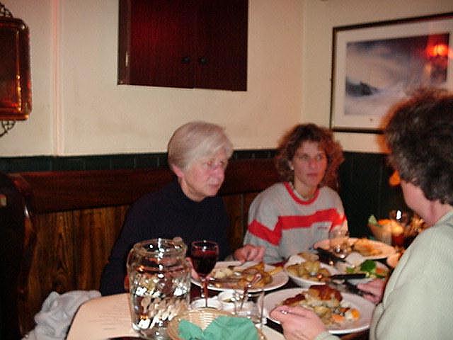 |
I preferred the lamb roast, but the dauntless went for the beef and the Yorkshire pudding | |
Welcome
Introduction
Program
Participants
Hiking Area
Comments
Links
Day One
Day Two
Day Three
Day Four
Day Five
Day Six
Day Seven
Homeward bound
Photo Day Two Album
Inquiries Henk Schout
| Email: lagedor |
|
 |